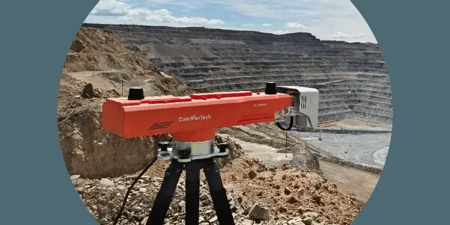
Blackburn sits on a mix of Millstone Grit and Lower Coal Measures, with steep valleys carved by the River Blakewater. We see it often: slopes that look stable in summer start creeping after a wet winter. That is why monthly geotechnical slope monitoring is not just paperwork — it is the difference between a minor crack and a full slope failure. Our team installs inclinometers and surface markers, then returns every 30 days to log readings. Before we set up the network, we often run a MASW Vs30 survey to map the shear-wave velocity profile across the slope. That data tells us where the weak layers sit. We also cross-reference with clasificacion de suelos to confirm the soil type at each monitoring point.
A monthly monitoring cycle catches the progressive creep that a single pre-construction survey would miss entirely.
Technical details of the service in Blackburn
- Inclinometer deflection (mm)
- Piezometric level (m below surface)
- Crack width at surface markers
- Rainfall accumulation since last visit
Procedure video
Risks and considerations in Blackburn
The south side of Blackburn, near the M65 corridor, has deeper glacial till deposits that can trap water in lenses. Compare that to the sandstone ridges in the north, where seepage follows joints. Monthly monitoring in Blackburn picks up both patterns. If the till lens starts saturating, the inclinometer shows a sudden deflection spike. On the jointed sandstone, the crack gauge widens gradually. We flag both scenarios in the monthly report and recommend a follow-up with asentamiento diferencial analysis if the movement is concentrated in one zone. The real risk is silence — assuming the slope is fine because it rained less last month.
Our services
We bundle monthly slope monitoring with three complementary services to give a complete picture of slope behaviour in Blackburn.
Inclinometer Installation & Survey
We drill and install inclinometer casings to depths up to 30 m, then take a baseline reading. Each month we run a probe and compare the profile to the baseline. The output is a deflection graph with depth, flagged at any shear zone.
Piezometric Monitoring
Standpipe or vibrating-wire piezometers measure the groundwater level at each monitoring point. We log readings monthly and correlate them with rainfall data from the nearest Met Office station in Blackburn. Rising levels trigger a re-run of the slope stability model.
Surface Crack & Marker Survey
We install stainless steel pins across tension cracks and along the slope crest. Each month we measure the gap with a digital calliper and record any new cracks. The trend line tells us if the slope is accelerating toward failure.
Common questions
How does monthly slope monitoring prevent failure in Blackburn's terrain?
Blackburn's slopes are underlain by Coal Measures interbedded with sandstone, which can soften when water seeps along bedding planes. Monthly readings catch the progressive creep before it becomes a rapid slide. The inclinometer data combined with piezometer levels gives a lead time of weeks to months, enough to install drainage or trim the slope.
What is the typical cost of monthly geotechnical slope monitoring in Blackburn?
For a standard slope with 3 inclinometers and 5 surface markers, the monthly service runs between £360 and £1,110 including data collection, field report, and trend analysis. The range depends on site accessibility, casing depth, and whether we need night-time traffic management near the M65.
How long does the monitoring programme typically last?
Most projects run 12 to 24 months, covering at least two wet winters. If the slope stabilises after drainage works, we may reduce to quarterly visits. We review the trend every six months with the client and adjust the frequency accordingly.
What qualifications does your monitoring team hold?
Our field technicians are competent in BS EN 1997-1 and hold CITB safety cards. The laboratory is ISO 17025-accredited for geotechnical testing. Each monitoring report is reviewed by a chartered geotechnical engineer registered with the ICE or Geological Society.