Ground investigation in Blackburn forms the critical first phase of any construction or civil engineering project, providing essential data about subsurface conditions that directly influence design, safety, and cost. This category encompasses a range of intrusive and non-intrusive techniques used to characterise soil, rock, and groundwater profiles across the borough. Without a thorough understanding of what lies beneath the surface, developers risk encountering unforeseen ground conditions that can lead to project delays, structural failures, or excessive foundation costs.
Blackburn’s geological setting presents a varied and sometimes challenging landscape for construction. Much of the town centre and southern areas are underlain by the Pennine Lower Coal Measures, comprising interbedded sandstones, siltstones, mudstones, and historic coal seams. These strata can be highly variable over short distances, with weathered zones and potential voids from shallow mining activity. To the north and west, glacial till and fluvioglacial deposits from the last ice age blanket the solid geology, creating a mantle of cohesive boulder clays and granular sands and gravels that exhibit distinct engineering behaviours. Understanding this complex drift-bedrock interface is paramount, and techniques like the Standard Penetration Test (SPT) are routinely used to assess the density and strength of these granular soils.
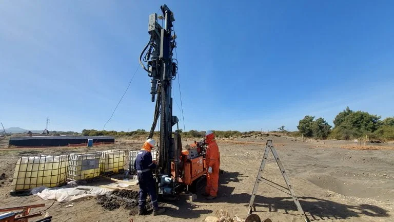
All ground investigation work in Blackburn must comply with the rigorous framework established by British Standards, most notably BS 5930:2015+A1:2020, the code of practice for ground investigations. This standard governs everything from the planning and execution of fieldwork to the description of soils and rocks and the presentation of factual and interpretative reports. Depending on the project’s nature and location, Eurocode 7 (BS EN 1997) also applies for geotechnical design, requiring a defined level of investigation to support the selected Geotechnical Category. Furthermore, given the region’s coal mining legacy, a Coal Mining Risk Assessment is often a mandatory planning requirement, necessitating targeted investigation to locate and treat shallow workings.
The scope of a ground investigation is tailored to the specific project but typically involves a phased approach. A desk study first collates historical maps, geological records, and environmental data. This informs the physical fieldwork, where methods are selected based on the anticipated ground conditions and the engineering questions that need answering. For examining shallow foundations or locating services, exploratory test pits offer a direct visual inspection of the near-surface strata. For deeper profiling and continuous assessment of soil behaviour, particularly in the soft alluvium found in the river valleys, Cone Penetration Testing (CPT) provides high-resolution data on tip resistance and sleeve friction, which can be correlated to a wide range of geotechnical parameters. These methods are essential for a diverse array of projects, from residential housing estates on former industrial land to highway embankment assessments and the construction of new commercial developments. Any project that transfers load to the ground or alters the groundwater regime will require a site-specific investigation to de-risk the development and satisfy building control requirements.
Questions and answers
Why is a ground investigation necessary before building in Blackburn?
A ground investigation is essential to identify the specific soil and rock conditions, groundwater levels, and potential hazards like shallow coal mine workings that are prevalent in Blackburn. This data is critical for designing safe and cost-effective foundations, mitigating risks of subsidence, and complying with building regulations and planning conditions, ultimately preventing unforeseen construction costs and structural issues.
What British Standards govern a ground investigation in the UK?
The primary standard is BS 5930:2015+A1:2020, which provides the code of practice for all stages of a ground investigation. For geotechnical design, Eurocode 7 (BS EN 1997) is mandatory, setting out the requirements for investigation scope based on the project's complexity and risk. These standards ensure a consistent and rigorous approach to site characterisation.
How long does a typical ground investigation in Blackburn take to complete?
The duration varies significantly with project scale and complexity. A simple site investigation with a few trial pits for a house extension might be completed in a day, whereas a major intrusive investigation involving multiple boreholes and CPTs for a large commercial development can take several weeks on site, followed by a further period for laboratory testing and factual report writing.
What is the difference between a factual and an interpretative ground investigation report?
A factual report presents all the raw data obtained from the field and laboratory without any engineering judgement, including borehole logs, test results, and site observations. An interpretative report, prepared by a geotechnical engineer, analyses this data to assess ground risks, derive design parameters for foundations, and provide recommendations for earthworks and groundwater control.