Blackburn sits on a varied geological sequence of Millstone Grit, shales, and coal measures, with drift deposits of glacial till and alluvium over much of the urban area. The town lies about 130 m above sea level on the western edge of the Pennines, where the bedrock is often folded and faulted from the Variscan orogeny. For any major infrastructure or deep excavation here, conventional boreholes alone rarely capture the full picture of subsurface structure. That is where seismic tomography becomes essential: by measuring P-wave and S-wave velocities across an array of geophones, we build a 2D or 3D velocity model that reveals buried channels, fault zones, and rockhead geometry with far greater resolution than point sampling alone. In our experience, a well-designed refraction or reflection survey in Blackburn can detect features as subtle as a 2 m offset in bedrock, which might otherwise go unnoticed until excavation begins. We often combine this with MASW-Vs30 profiling to characterise shear-wave velocity for seismic site classification, or with geotechnical boreholes where disturbed samples are needed for laboratory testing.
Seismic tomography in Blackburn reveals buried channels and fault zones that conventional boreholes miss, reducing ground-risk uncertainty before excavation begins.
Technical details of the service in Blackburn
Risks and considerations in Blackburn
Blackburn expanded rapidly during the Industrial Revolution, with mills, canals, and railways built over shallow mine workings and poorly compacted backfill. Many of these former colliery sites and quarry voids were later developed for housing and retail without adequate ground investigation. The risk today is that old workings — often unrecorded on historical plans — can collapse under new loading, or that infilled ground undergoes differential settlement during wet-dry cycles. Seismic tomography provides a non-invasive method to scan large areas of such brownfield land, identifying anomalous low-velocity zones that may indicate voids or loose fill, before committing to expensive intrusive investigation. We have used this approach on several Blackburn regeneration sites to map the extent of shallow mining and to design appropriate remediation, such as grouting or deep foundations, with confidence.
Our services
Our seismic tomography services in Blackburn cover the full workflow from survey design through data acquisition, inversion, and interpretation. We tailor each campaign to the specific geological setting and project objectives.
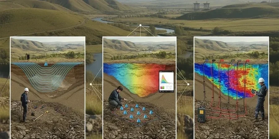
Refraction Tomography
P-wave first-arrival travel-time inversion to produce 2D velocity models of the shallow subsurface. Ideal for mapping rockhead, weathered zones, and the extent of glacial till deposits common in Blackburn. Typical depth range 5–30 m with ±5 % velocity accuracy.
Reflection Tomography
High-resolution imaging of deeper structures including faults, bedding planes, and mine workings using reflected wavefield data. Suitable for depths of 10–60 m where refraction alone cannot resolve velocity inversions or steeply dipping interfaces.
MASW & Surface-Wave Analysis
Shear-wave velocity profiling using multichannel analysis of surface waves (MASW) for seismic site classification per Eurocode 8. We derive Vs30 values and 1D velocity profiles that complement P-wave refraction data, particularly on Blackburn's alluvial deposits.
Common questions
How does seismic tomography differ from a standard borehole investigation in Blackburn?
A borehole gives precise data at a single point, but lateral variability in Blackburn's glacial till and bedrock can be high. Seismic tomography provides continuous 2D or 3D velocity information across the entire survey line, revealing changes in material stiffness, buried channels, and fault zones that a grid of boreholes might miss. We typically use tomography to target borehole locations, making the overall investigation more efficient.
What is the typical cost range for a seismic tomography survey in Blackburn?
For a standard 120 m line with 48 geophones and full refraction/reflection processing, the cost typically falls between £1.880 and £3.780 depending on site access, line length, and required resolution. This includes mobilisation, data acquisition, inversion, and a detailed interpreted report. Large or multiple-line surveys reduce the per-line cost.
Can seismic tomography detect abandoned mine workings under Blackburn?
Yes, provided the void or backfilled workings create a sufficient velocity contrast with the surrounding rock. Air-filled voids produce very low P-wave velocities (around 340 m/s) and strong diffraction patterns, while water-filled or collapsed workings may appear as low-velocity zones. The technique works best when the void is more than 1 m in size and within 20 m of the surface. We always validate anomalies with targeted boreholes or trial pits.
How long does a seismic tomography survey take on a typical Blackburn site?
A single 120 m line with 48 geophones can be deployed, shot, and demobilised in one day for an open site. Data processing and interpretation take another two to three working days, so you can expect a final report within one week of fieldwork. Larger surveys or those requiring reflection processing may take up to two weeks.